How Many Arches Have Fallen At Arches National Park?
No official tally exists for collapsed arches, but the park's documented spans, record holders and the geology that both builds and destroys them tell the story.
Why Do Arches Collapse In Arches National Park?
There is no official count. The National Park Service documents more than 2,000 standing arches at Arches and describes the park as the densest concentration of natural stone arches in the world, but it publishes no running tally of arches that have collapsed. Erosion works continuously and mostly unwitnessed, so a fallen span is often recorded only when someone notices a changed skyline.
That answer surprises people, and it is worth sitting with for a moment. A question that sounds like it should have a number, the kind of statistic a park brochure might print, turns out to have none. The arches themselves are the evidence of a process running in both directions. The same forces that carved more than 2,000 documented openings out of Entrada sandstone are the forces that will eventually close each account. Erosion does not file reports.
What the park does count is what stands. Over 2,000 documented arches across 76,519 acres, with elevations running from 4,085 feet at the visitor center to 5,653 feet at Elephant Butte. The documentation standard matters here too: an opening only joins the list when it meets a size threshold and has been recorded, so the real number of spans, large and small, is higher than the documented figure. Some of those undocumented openings have almost certainly fallen without anyone logging the event.
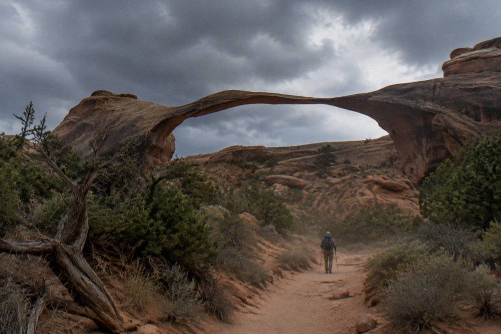
The practical takeaway for a visitor is simple. Every arch you see is temporary on a geological clock, and a handful of the park's most photographed spans look it: long, slender, and visibly thinner at the middle than at the feet. Nobody can tell you which one goes next or when. Geologists will not put a date on it, and neither will a guide, because the honest answer is that the rock decides.
Seeing the collection while it is intact is the reason roughly 1.5 million visits a year come through the gate, and a guided loop is the most efficient way to do it. The Arches National Park Tours comparison on our homepage lays out the options side by side, and the trio below covers the three most common ways people answer the question for themselves: a guided van loop, a shorter half-day version, and a flight that puts the whole span-studded plateau in one frame.
What Makes Arches National Park Unique?
The park holds the densest known concentration of natural stone arches on Earth, more than 2,000 documented spans packed into 119 square miles of southeast Utah desert. It became a national monument on April 12, 1929 and a national park on November 12, 1971, and it is also certified as an International Dark Sky Park, which pairs stone formations by day with naked-eye stars at night.
Density is the word the National Park Service itself leans on, and it is the right one. Other parks have arches; Arches has them crowded together, stacked along fins and canyon rims within a short drive of one another. The reason is a rare alignment of a soft sandstone layer, a hard cap rock above it, and a salt bed underneath that deformed and cracked the overlying rock into long parallel ridges. Water attacked the cracks, wind finished the job, and openings grew where the walls thinned through.
Uniqueness also explains the fragility behind the original question. An arch is what remains when the rock around it has already left. The park's own rules reflect that: no climbing on any arch, no drones anywhere in the park, and no artificial light aimed at rock features for night photography. These are not fussy regulations, they are protections for forms that took thousands of years to shape and can be altered in seconds.
The Dark Sky certification rounds out the picture. Arches sits far from major light pollution, and the NPS encourages night sky viewing after dark at spots like Panorama Point. Ranger-led stargazing programs run occasionally spring through fall, often near a new moon, rotating among Arches, Canyonlands and Dead Horse Point. A span you photographed at golden hour becomes a silhouette against the Milky Way three hours later.
If the geology story is what draws you, a guide who tells it well is worth the ticket. The Moab Tourism Center panoramic van tour builds its four-hour loop around exactly this narrative, from salt bed to sandstone fin to finished arch, and it includes the park entrance fee in its from $159 per person price. It is rated 5.0 across 879 reviews, the deepest review pool of any van-format tour in Moab.
Will A Delicate Arch Eventually Collapse?
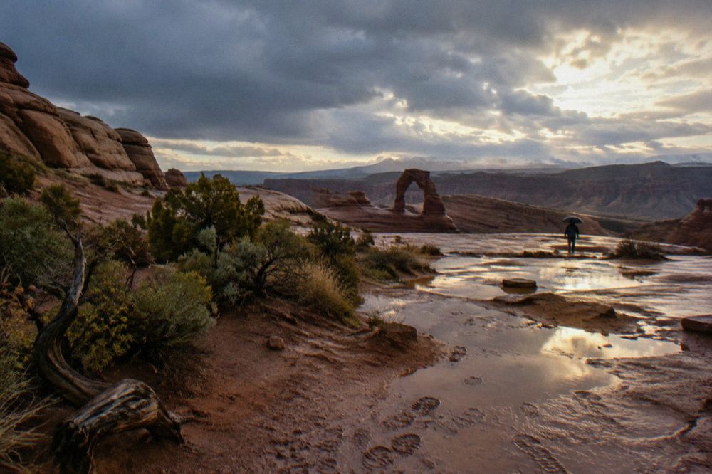
Yes, on a geological timescale, and the National Park Service says as much by describing every arch as temporary. Delicate Arch is the largest free-standing arch in the park, with an opening 46 feet high and 32 feet wide, and nothing in its shape exempts it from erosion. No date can be given, and no geologist will offer one, because collapse timing depends on rock strength and storm events that cannot be forecast.
The question gets asked because Delicate Arch is the icon, the one on the license plate and the postcards, and because its silhouette looks exactly like the kind of thing that should not still be standing. The trail to reach it runs 3 miles round trip and climbs 480 feet, passing the Wolfe Ranch cabin and a Ute petroglyph wall along the way. At sunset the amphitheater around it can hold hundreds of people, all photographing a form that exists because an entire rock fin eroded away except for one span.
Erosion never pauses. Freeze-thaw cycles pry at the sandstone grains, wind carries them off, and occasional heavy rain from late-summer monsoon storms accelerates the work. The NPS describes monsoon cells as violent and capable of causing flash floods, the same water-driven processes that carve arches also widening them toward failure. Every arch in the park is a countdown with an unknown clock face.
There is a policy dimension too. Commercial tour groups face limits on hiking to the arch itself under their park authorizations, and no one may climb on any arch, precisely because the resource is both beloved and finite. If the trailhead lot is full, visitors who start from the viewpoint lot face a 5-mile round trip rather than 3, and the lower viewpoint offers a level 100-yard walk with the arch visible from about a mile away for anyone who wants the sight without the climb.
For travelers who want the amphitheater moment with a guide handling logistics, the sunset tour with guided walks covers timing and tour options in depth. The Moab Adventure Center sunset tour runs four hours from $142 per person with snacks and water included, though the park entrance fee is not, so bring a pass.
Which Arches Hold The Park's Records?
Landscape Arch is the longest documented arch in the park at 306 feet across its opening, and Double Arch South is the tallest at 112 feet. Delicate Arch holds the largest free-standing title with its 46-by-32-foot opening. The park documents over 2,000 arches in total, and new documentation occasionally adds to the list as surveyors reach remote areas.
Record holders are where the fallen-arches question gets concrete, because length is a liability. A 306-foot span is carrying more weight with less material per foot than any other arch in the park, and Landscape Arch's ribbon-thin profile makes the physics visible from the viewing deck. The NPS recommends the all-terrain wheelchair for the Landscape Arch trail, one of the more accessible approaches in the park, so the record holder is also one of the easiest big spans to see up close.
| Arch | Record held | Measurement | Notes |
|---|---|---|---|
| Landscape Arch | Longest span | 306 feet | Thinnest profile of the major arches; accessible trail recommended for all-terrain wheelchairs |
| Double Arch South | Tallest opening | 112 feet | Paired with the better-known Double Arch in the Windows section |
| Delicate Arch | Largest free-standing | 46 feet high, 32 feet wide | 3-mile round trip trail with 480 feet of climbing |
| Park total | Documented arches | Over 2,000 | Densest concentration of natural stone arches in the world |
The number 2,000 carries a caveat worth repeating: documented is the operative word. Survey criteria set a minimum opening size, and remote fins and canyons within the 76,519 acres are still being catalogued. A span that collapsed in a rarely visited corner between surveys would vanish from the ledger without ever appearing in it, which is the quiet reason no fallen count exists.
None of the record holders can be replaced once changed, and the park's rules exist for that reason. Climbing on any arch is prohibited, drones are banned park-wide, and pets are not allowed on trails at all. The sensible reading of every regulation in the park is that the resource is assumed to be under active loss, slow but permanent, and managed accordingly.
How Do You See The Most Arches Before More Of Them Change?
A four-hour guided loop hits the major spans in one pass, and the two van-format tours that include the park entrance fee, the panoramic van at from $159 and the half-day at from $139 per person, are the efficient options. A 30-minute scenic flight from Canyonlands Field adds the aerial view of the whole arch-studded plateau at from $255 per person.
Guides earn their fee on this terrain not by driving but by explaining, and the erosion story is the spine of every good Arches tour. A naturalist guide can point at a fin, describe the salt bed that buckled it upward, and trace with a finger where the next opening is thinning, which turns a scenic drive into a geology lecture you can see. The Moab tour companies guide breaks down the operators by style and group size for anyone comparing.
The Mild to Wild half-day tour deserves its own mention for families. At from $139 per person it is the cheapest guided option in Moab, includes the park entrance fee and cold drinks, and runs a junior ranger program for kids under 12, all in a four-hour window with a 14-person cap. It is rated 4.8 across 117 reviews.
For the aerial angle, Redtail Air's 30-minute Arches flight lifts off from Canyonlands Field Airport, 11 miles from the park entrance, and carries up to five guests with live commentary on board. It is rated 5.0 across 44 reviews, from $255 per person, and no park pass is needed since the airplane never touches park roads. The tours here also include an 80-minute Canyonlands and Arches combo flight from $480 per person for the fuller circuit.
Timing matters as much as format. The NPS recommends entering before 8 am or after 3 pm to avoid traffic between March and October, when entrance waits can exceed 60 minutes, and summer trailhead lots routinely fill by 7:30 am. In 2026 there is no timed-entry reservation to book, so the trade is simply arrival time: early morning tours dodge the queue, and sunset tours arrive after it thins. The self-drive crowd also had the Moab-Arches shuttle, a 2026 pilot that was free with a valid park pass and ran pickups every 15 to 30 minutes, with the last Delicate Arch departure at 4:05 pm. Service for 2027 has not been announced.
The entrance fee itself is $30 per private vehicle, valid for the standard seven-day window the NPS fees page describes, or $15 per person on foot or bicycle, with youth 15 and under free. America the Beautiful pass holders get in on the pass, and the van tours that list the entrance fee as included fold that cost into the ticket, which is one reason they price slightly higher than tours where you bring your own pass. Full fee details and the 2026 fee-free days are on the NPS fees page.
Whether any given span stands for another century or another decade, the collection as a whole is being remade constantly: new openings form while old ones fail. The park's quick facts page keeps the official documentation, and current conditions are always on the NPS conditions page. Whichever way you see it, van, foot or wing, you are looking at a work in progress.
Common Questions About Fallen Arches At Arches
How Many Arches Have Fallen At Arches National Park?
No official count exists. The park documents over 2,000 standing arches and describes itself as the densest concentration of natural stone arches in the world, but it keeps no public tally of collapsed spans. Falls happen unwitnessed in remote areas, and undocumented arches leave no record when they go.
Will A Delicate Arch Eventually Collapse?
Yes, on a geological timescale. Delicate Arch is the largest free-standing arch in the park, an opening 46 feet high and 32 feet wide, and nothing exempts it from the same erosion that formed it. No forecast date exists, and no geologist will offer one.
What Makes Arches National Park Unique?
It holds the densest known concentration of natural stone arches on Earth, over 2,000 documented spans in 119 square miles, and it is an International Dark Sky Park. It was designated a national monument in 1929 and a national park in 1971.
Which Arch In The Park Is Most Likely To Fall Next?
Nobody can say, and any guide or operator claiming to know is guessing. Length is a structural liability, and Landscape Arch carries the longest span in the park at 306 feet, but collapse timing depends on rock strength and storm events that cannot be predicted.
Are Drone Flights Allowed To Document The Arches?
No. Unmanned aircraft are prohibited throughout Arches National Park, with no recreational exceptions. Climbing on any arch and using artificial light to illuminate rock features are also banned.